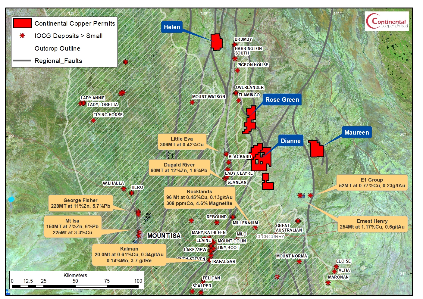
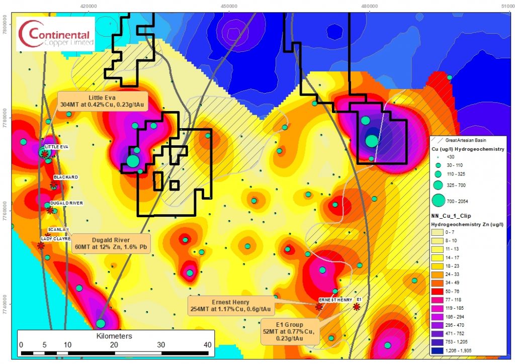
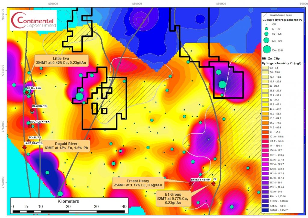
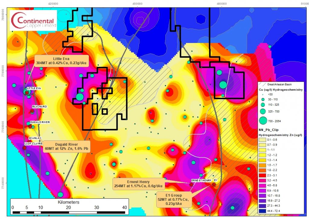
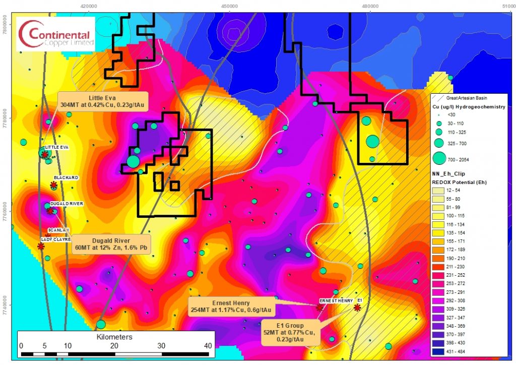
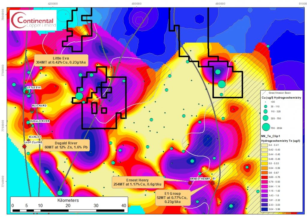
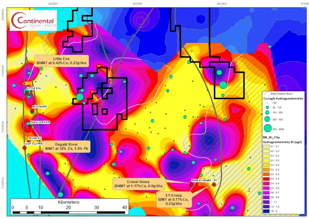
Continental Copper has six exploration permits covering 980 km2 in the sparsely explored terrane north of Ernest Henry (245 Mt at 1.2% Cu and 0.6 g/t Au) and east of Dugald River (60Mt at 12% Zn and 1.6% Pb) and Little Eva (306Mt at 0.42% Cu, 0.23 g/t Au). This area is the most prospective Cu-Au and Zn-Pb-Ag target terrane in the Mt Isa region.
A Compilation of the Recently Released 3D Inversion of the Cloncurry Magnetotelluric Survey. This presentation demonstrates the applicability of MT to delineate metallogenically important structural features and the generation of valid exploration targets – with potenital for major discovery.
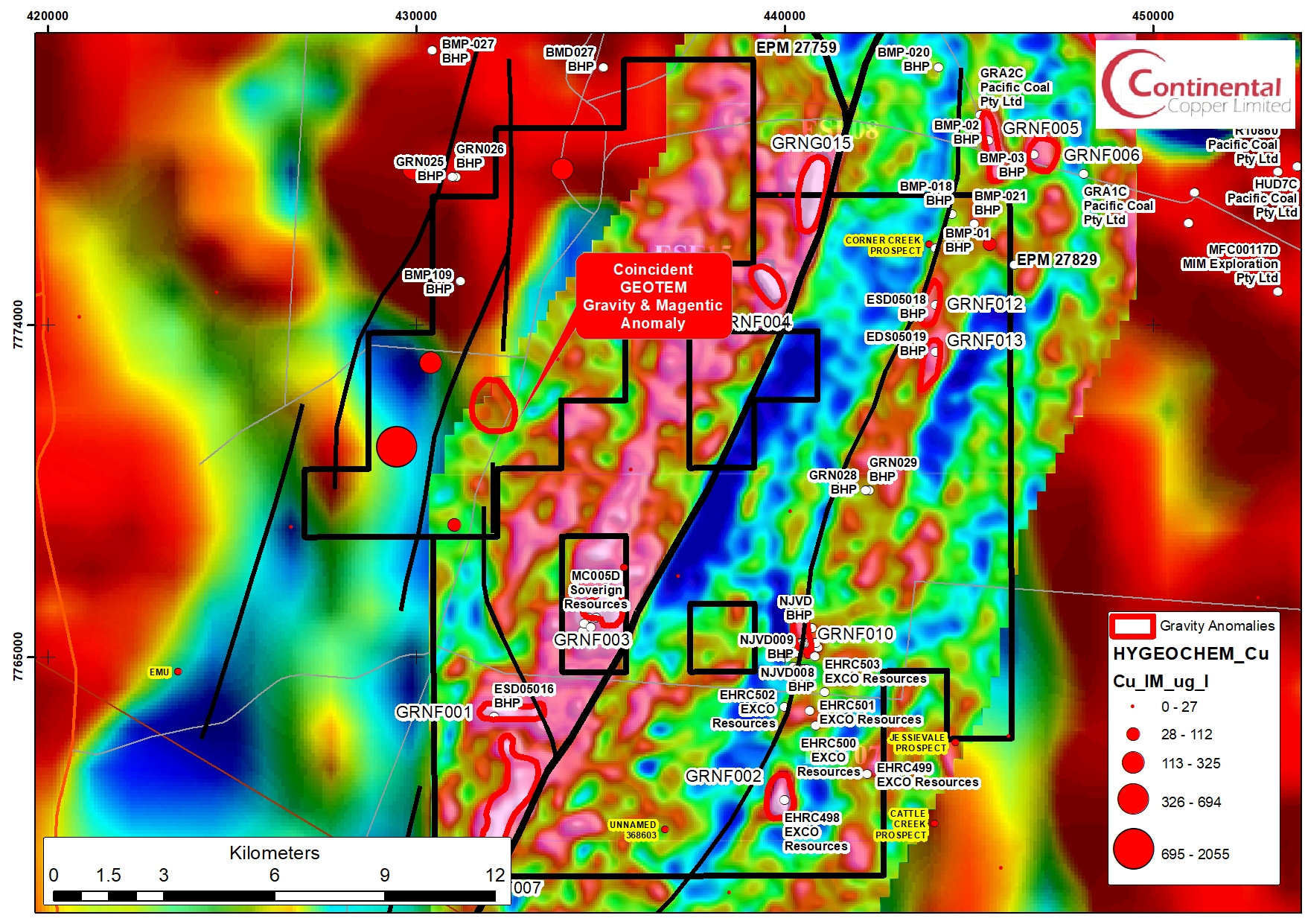
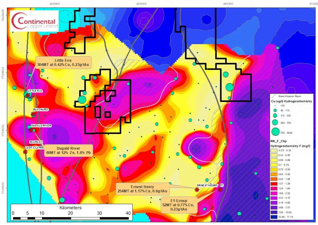
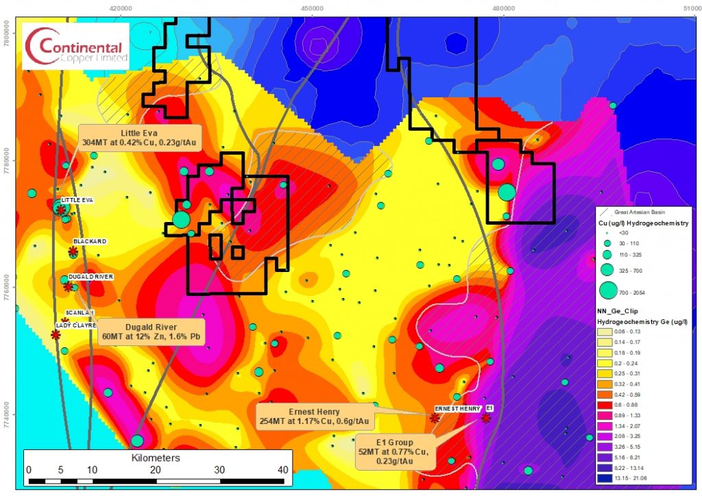
Continental projects were acquired based upon an 11,000km2 water-bore geochemical survey. The highest Cu-Pb-Zn bore-water geochemistry outside of the immediate mine areas is located in multiple samples within the Continental Copper licences. Lead isotope geochemistry confirms the prospectivity of the anomalies.
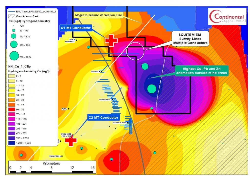
A 4,000 km2 Magnetotelluric (MT) geophysical survey has generated prominent and unexplained conductivity anomalies within the Continental Copper licences coincident with the Gidyea Suture and the Mt Margaret Fault system. A very strong and undrilled EM conductor coincides with the geochemistry and the MT conductor. This EM anomaly has been modelled as three separate conductors with strikes of 3km to a depth of 1.5km.

Continental Copper licences are in a well mineralized and structurally complex area, with coincident untested high-order geochemical and geophysical anomalies. Continental Copper is about to change the way that exploration is conducted under-cover in Australia, reducing risk and increasing discovery rates in deeply covered regions.